On March 5, 2016, OpenLexington and maptimeLEX, local groups committed to open learning and open data, joined forces to host Lexington’s 2016 CodeAcross event. CodeAcross, initiated by Code for America, is a worldwide weekend long initiative to organize action of its network of civic hacking volunteer groups. CodeAcross events work to produce open source technology solutions, data accessibility, and services for the citizens, by citizens. Code for America hosted its 5th annual CodeAcross civic hacking weekend March-5-6, 2016, coinciding with International Open Data day.
The goal of Lexington’s CodeAcross 2016 event was to import precise building footprints and associated addresses into a free and publicly available mapping platform OpenStreetMap (OSM). HDI’s Anna Bard was able to contribute time to this effort this past month, participating in the hackathon in support of Nearby Explorer, an application powered by OSM and developed by the American Printing House for the Blind. The attendees of the event worked collaboratively to import building footprints and attached addresses into OpenStreetMap to provide the application with the data it needs to be useful to individuals with visual impairments in our community.
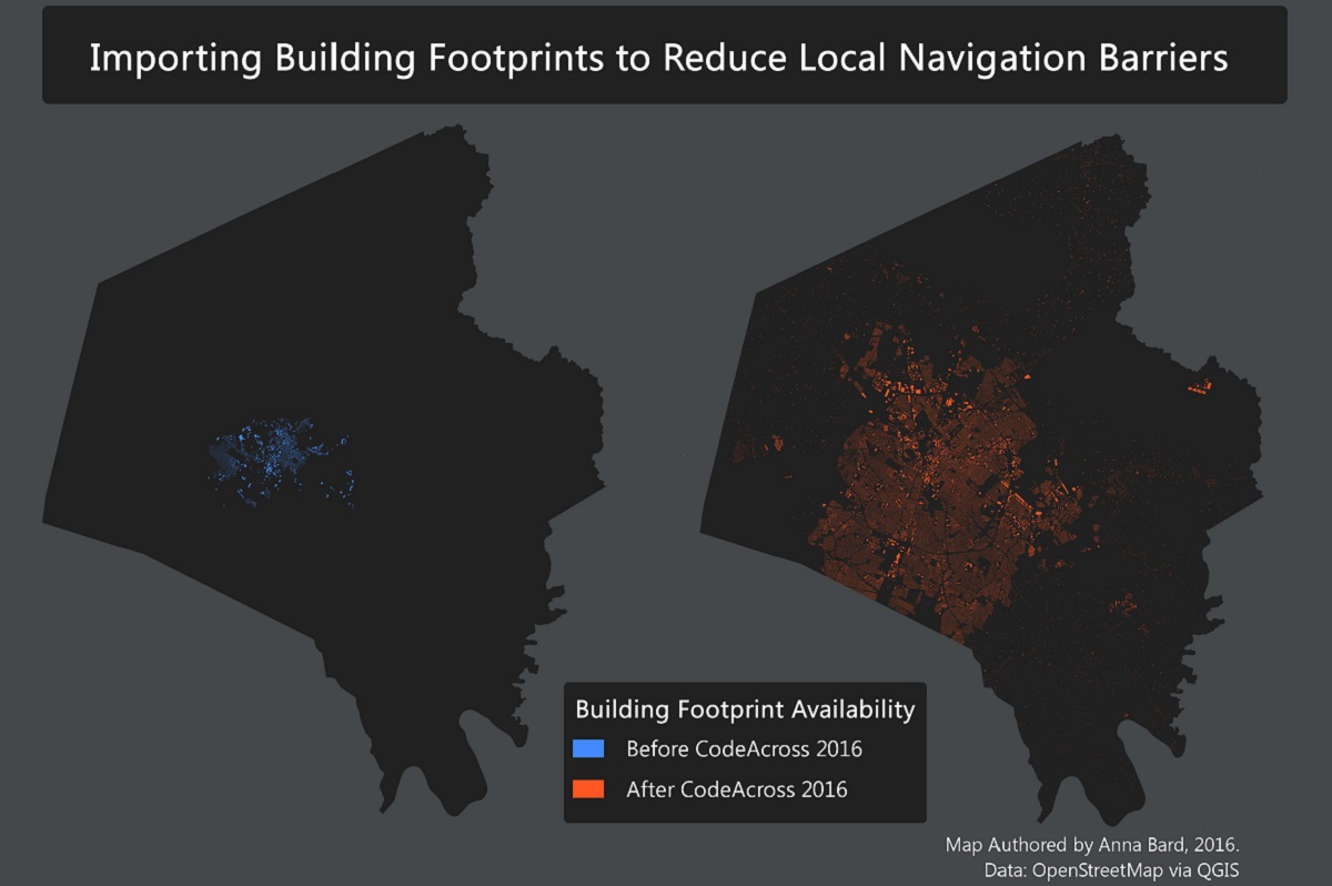
Nearby Explorer is a navigation application designed for use by individuals with vision impairment. The application announces location related information as the user moves through their community. Previous to this event only 5% of Lexington’s building footprints and 2% of building addresses were available to the application via OSM. The lack of open citywide data obstructed the effectiveness of the Nearby Explorer application as well as other OSM based services. Today, approximately 87% of the buildings in Fayette County, Kentucky have been imported into OSM. Volunteer mappers continue to donate time to this effort.
Watch this video for a demonstration of one of Nearby Explorer’s many features: https://www.youtube.com/watch?v=7AzEYDRZeBo